“Borinda” is a common nickname used to describe the relatively uneventful town of Orinda. Many may seek entertainment or activities in neighboring cities such as Berkeley, Walnut Creek, or through the tunnel Oakland and San Francisco. The belief that Lamorinda has nothing special to offer isn’t true. For, throughout the area, there are hidden gems that can provide views and scenery that may not be commonly found.
De Laveaga Trail
Distance: 1.2 Miles
Time finish: 30-45 minutes
EBMUD Permit: Required
Right off Camino Pablo near Orinda Safeway, the De Laveaga Trail stands as a tough but rewarding uphill hike through Orinda. The hike itself crosses through meadows where cows can be seen roaming free through the grass. As one keeps hiking, the view gets better and better. 15 minutes in, one will see all of downtown Orinda. At night, the old Orinda Theater sign can be seen flashing its neon lights. The hill gets noticeably steeper as the hike continues. Momentarily, the view will blocked by a towering oakwood forest; however, once this is cleared, one will be able to see almost all of Orinda and Moraga. But going just one fifth of a mile further, the view that shows the overwhelming majority of Contra Costa County greets the hiker. Since the visibility reaches up to 40 miles eastward, at night, the lights of wind turbines in the Central Valley can be seen along with all of Orinda’s hills, dotted with lights. Each one could be someone you know. The De Laveaga Trail view is perfect for those who want a great view of the east.
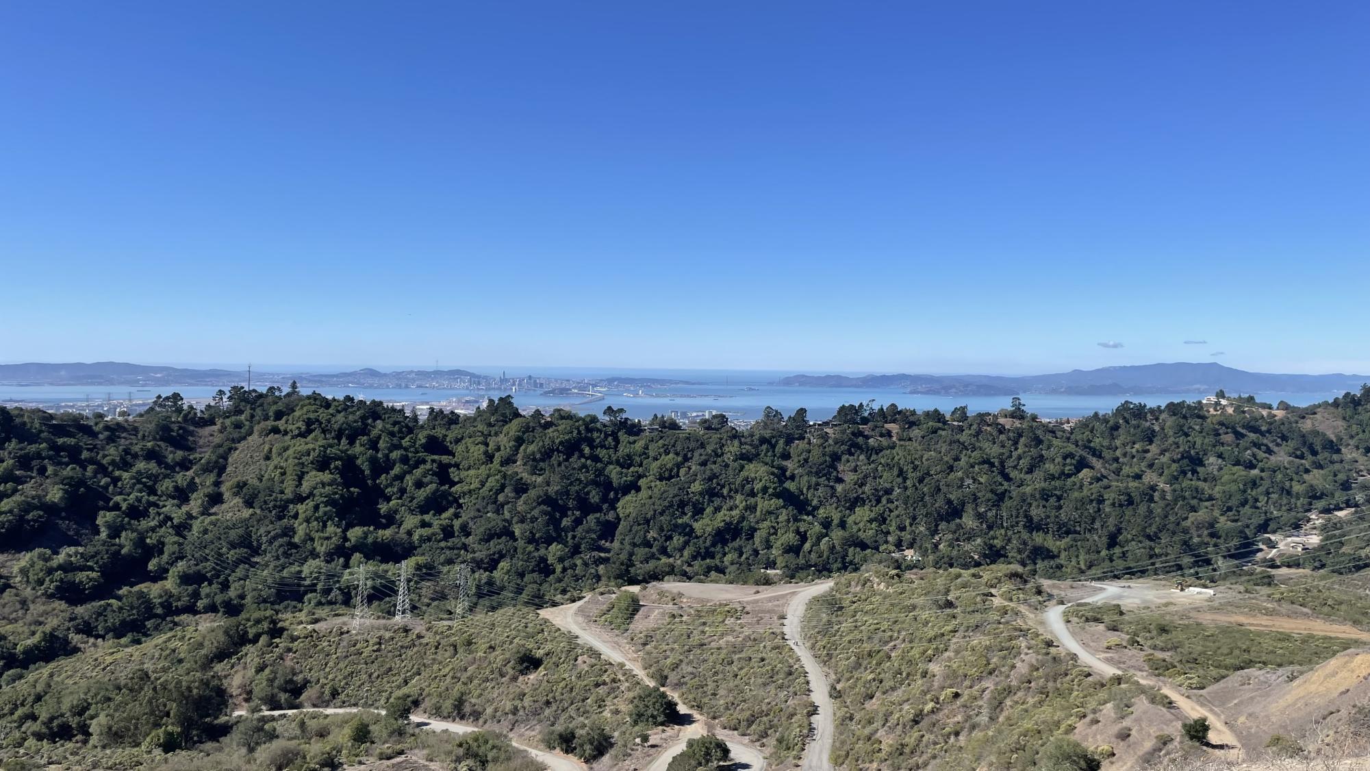
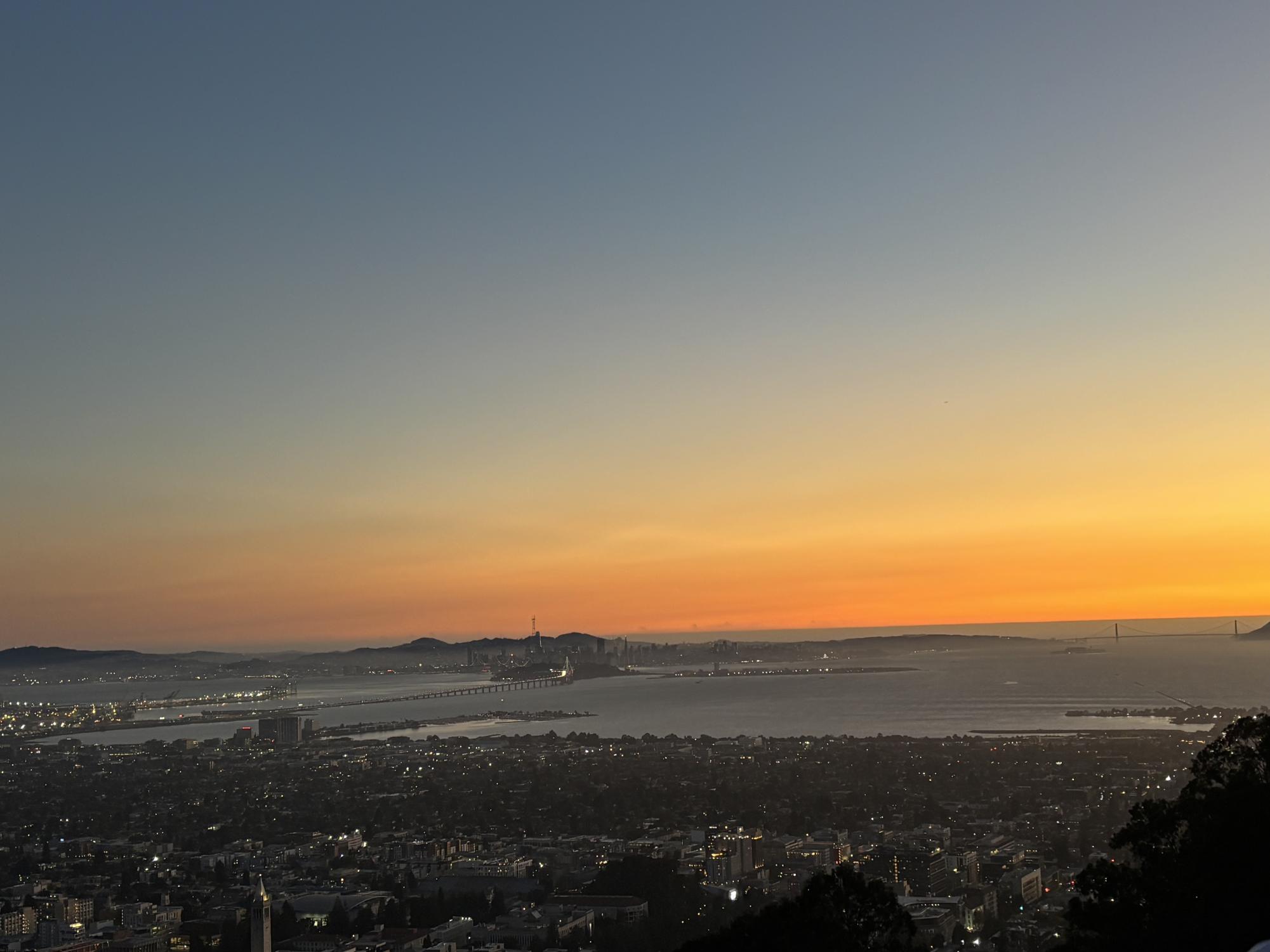
Sibley Volcanic Preserve
Distance: 1.15 Miles
Time to finish: 40 minutes
EBMUD Permit: Not Required
Starting in Wilder on Wild Lilac Way, the Sibley Volcanic preserve is a relatively easier hike compared to the De Laveaga Trail. While uphill sections are present, they are mild and infrequent. The main exception being the last segment of the hike. The hike heads uphill from Wilder and reaches the bulk of the park where one can then move northward on the Volcanic trail until they reach a cliffside clearing. From this clearing there a multiple possible trails, one of them leads to the top of a large hill. Once reaching the top of this mountain like hill, one will see a view of the entire bay: San Francisco, Oakland, the suburbs, and the beautiful Golden Gate Bridge. Beyond that, is the Pacific Ocean stretching for miles. All of this without the noise of city life and highways. There are also a series of cliffs to climb up and look over the edge. However it is recommended that one takes extreme caution when doing this. Those who are looking for a westward view of the bay and beyond will enjoy this Sibley Volcanic Preserve hike.
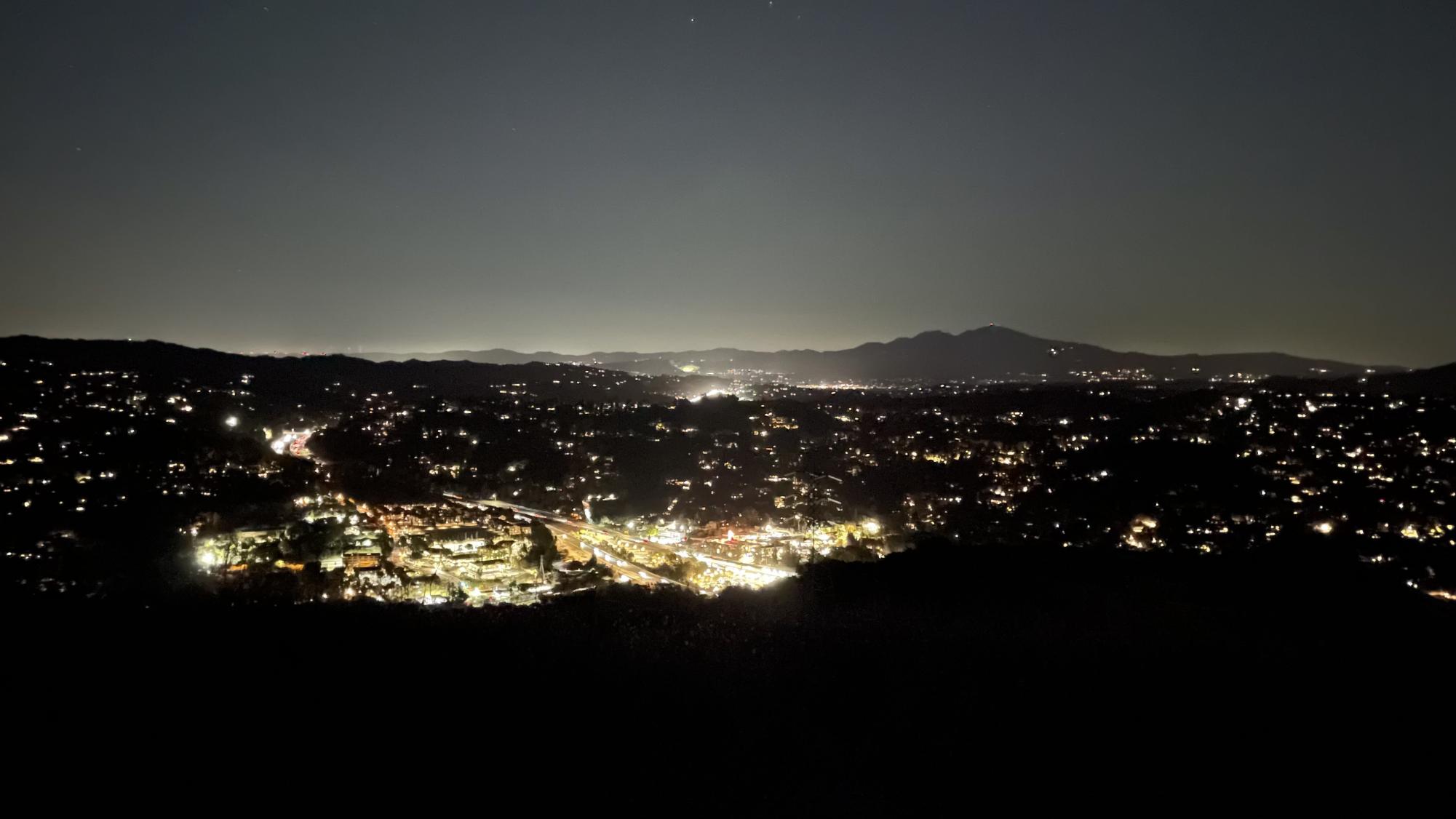
Lawrence Hall of Science Parking Lot
Distance to Finish: 0.0 miles
Time to finish: Depends on how far you live from the Lawrence hall of science
EBMUD Permit: Not Required
Every day, people, both regulars and tourists alike, try to see the sunset over the Bay Area. Everyone has their own preferred spots; one of the most popular is the logs and benches placed alongside Grizzly Peak Boulevard add one more example. While these are wonderful, they have unfortunately been blocked off due to excessive littering on the side of the road and on the benches. Parking alongside Grizzly Peak Boulevard has also been made illegal to combat littering even further. Thus, people have been looking for alternatives; specifically, legal and accessible alternatives. My answer for them is the Lawrence Hall of Science parking lot. It is completely open for anyone to park there, even if they themselves are not visitors. The views of the Bay Bridge, the Golden Gate Bridge, San Francisco, Oakland, and almost every single city along the Bay are stunning. If you get there roughly half an hour before sunset, you should have a decent amount of freedom of choice in where you can park. Some will back up their cars and open their trunks to sit in. When the time comes, the sky will turn golden and so will San Francisco. This view is magical and memorable for those who want to watch San Francisco slowly transition into the night.
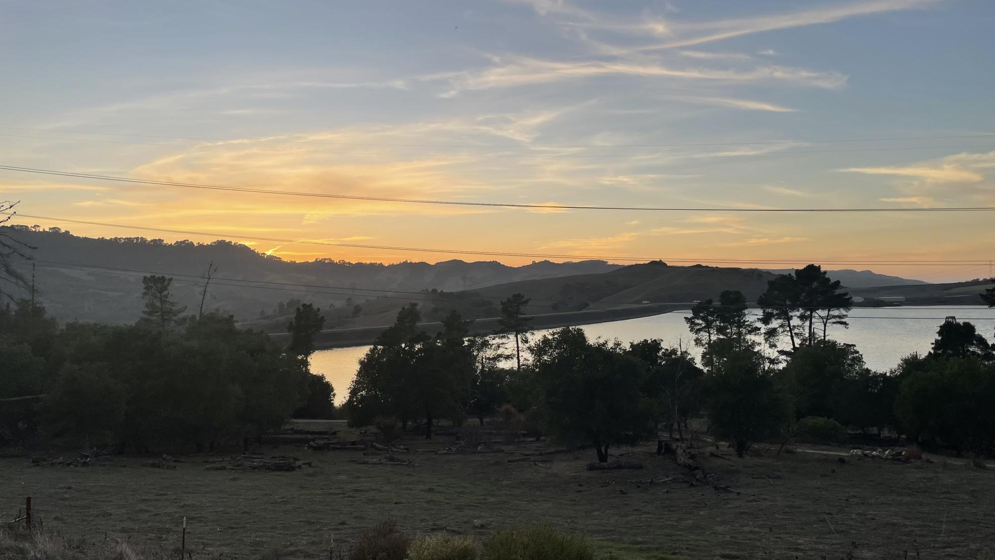
Briones Overlook Staging Area
Distance to Finish: 0.0 miles
Time to finish: Depends on how far you live from the area
EBMUD Permit: Not Required
While the view of San Francisco is gorgeous, some might want a more quiet experience. One more secluded from the typically loud environment of areas that overlook the Bay. The Briones Overlook Staging Area is more connected with nature than it is with the city. It provides views of the Briones Dam and Reservoir. There is no hiking involved (unless you want there to be). Simply pull into the parking lot and enjoy the sunset. As the sky turns pink and the sun begins to disappear behind the hills, the reservoir will begin to glisten in the day’s final moments. Its distance from the city allows for less light pollution, which provides another spectacle once night has fallen. For those who look for views that are more in touch with nature rather than the man-made world, the Briones Overlook Staging Area is an excellent view.